
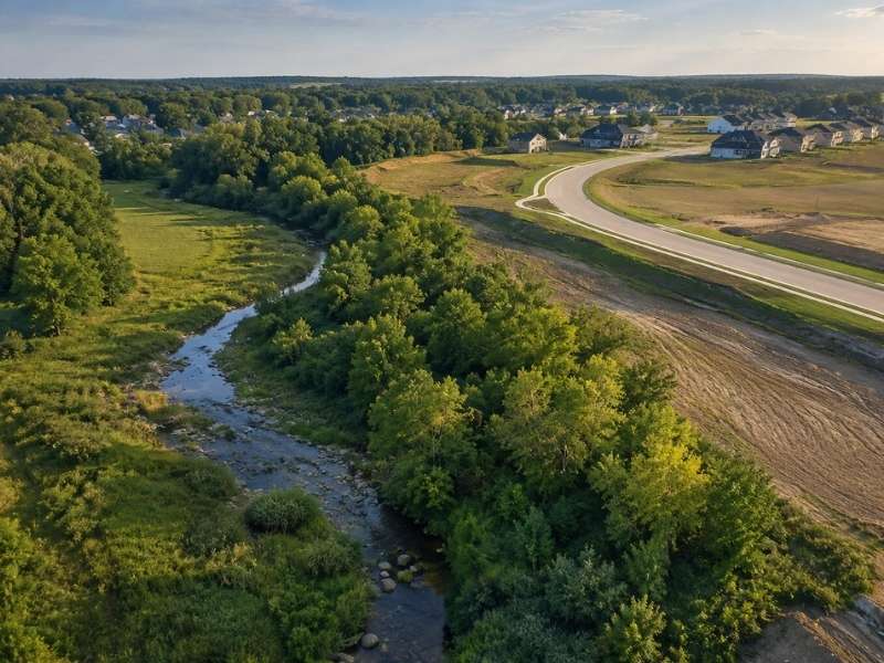
A creek does not move for your site plan. The water was there first, and it stays where it wants. Good land planning works with the stream, not against it. Respect the water and the natural areas early, and the rest of the plan falls into place. Fight them, and the plan fights back with delays and cost.
Streams come with rules and with real risk. Build too close, and you invite erosion, flooding, and failed reviews. This guide shows how to shape a site around streams and protected land. The goal is a plan that keeps its value and keeps the water healthy.
How Stream Buffers Define the Buildable Portion of a Site
A stream buffer is a strip of land next to a stream. Its job is simple. It filters dirty runoff, holds the banks in place, and shades the water. Because it does real work, the rules usually keep it off limits. You often cannot build, grade, or clear inside it.
The width of a buffer is not fixed. A perennial stream that flows all year may need a wide buffer. A small stream that runs only after rain may need less. Wetlands and riparian corridors add their own limits. Each strip takes a bite out of the usable area.
How the buffer gets measured
The starting line matters. Many rules measure the buffer from the top of the stream bank, not the water’s edge. That can push the line farther onto your land than you expect. Some buffers even come in two zones. An inner zone stays fully wild, while an outer zone allows light use.
So the buildable part of your site is what sits past all these lines. It is often smaller than the deed acreage hints. Find these limits before you place a single road or lot. Rules vary by place, so confirm the ones that apply to your parcel.
Why Topography and Drainage Matter Near Protected Areas
Land near a stream is rarely flat. The ground slopes down toward the water. Steep slopes cost more to grade, and they wash soil into the stream. Building on them adds risk you do not need. The best spots for homes and shops sit on higher, gentler ground.
Water already runs across your site. It follows low swales and gullies toward the stream. These are the natural drainage paths. Build over them, and you trap water where it wants to flow. That leads to flooding, wet basements, and angry neighbors.
Civil engineers read the land before they change it. They map the slopes and the flow paths first. Then they fit the plan to the ground. This keeps cut and fill low near the water. Less grading means less soil loss and a smaller bill.
Headwater areas need extra care. These are the small, wet spots where streams begin. They are easy to miss and easy to harm. Leave them alone, and the whole stream stays healthier.
Planning Roads and Utilities Without Fragmenting Natural Corridors
Roads and pipes must reach the whole site. Near a stream, that means crossings. A road may need to span the water. A sewer line may want to follow the low valley. Every crossing cuts into the protected area.
Crossings also cost time and money. Each one may need a state or federal permit. More crossings mean more review and more delay. The fix is smart routing. Aim for one shared crossing instead of three.
Keep the corridor in one piece
A connected corridor works better than a chopped-up one. It moves water, holds soil, and shelters wildlife. Each new crossing breaks that connection a little more. So group your utilities in a single corridor when you can. Cross the stream at a right angle to keep the disturbance small.
The crossing method matters too. An open trench through a stream causes a lot of damage. Boring a pipe under the stream can avoid that. Keep gravity sewer out of the buffer where the land allows. These choices protect the corridor and speed your approval.
How Stormwater Design Can Support Stream Protection
Development adds hard surfaces. Roofs, roads, and lots shed water fast. That water races toward the nearest stream in a hurry. Without control, it scours the banks and drops mud into the channel. Good stormwater design slows and cleans it first.
The goal is not just to hold water. It is to protect the stream’s shape and health. Detention releases water slowly so the banks do not erode. Water-quality steps trap dirt and pollutants before they reach the stream. A calm, spread-out discharge beats a hard, concentrated one.
Let the buffer share the load
The buffer itself can treat runoff. Grass and roots slow the water and filter it. A level spreader can turn a fast pipe flow into a gentle sheet. That sheet then soaks through the buffer instead of blasting the bank. Design the two to work together, and both do their jobs better.
Plan for upkeep from the start. Ponds and filters need cleaning to keep working. Leave a path to reach them. A facility no one can service will fail in a few years.
Balancing Development Goals With Long-Term Open Space
A stream corridor is not just a loss on your plan. It can be one of your best features. People pay more for green views and quiet water. A preserved stream can lift the value of every lot around it. The trick is to treat it as an asset, not a leftover scrap.
Turn the protected land into usable open space. Add a trail along the edge where the rules allow. Keep the big trees as a natural screen between uses. Let the corridor tie the neighborhood together. These moves make the site more appealing to buyers.
The green area also earns its keep in other ways. It gives runoff a place to go. It holds the wet, steep land you should skip anyway. It can meet the open-space rules many codes demand. One corridor can solve several problems at once.
The strongest sites make peace with the water. They keep buildings on the best ground and leave the stream to breathe. Years later, that stream is still an amenity, not a headache. Plan for it at the start, and it pays you back for the life of the site. That is what good land planning around natural areas really means.
